A Cleaner, Safer, Better KanpurSee it.
See it.
Report it.
Improve it.
CivicSense helps citizens report local civic issues, map them publicly, track progress and create a cleaner, safer and better city together.
Kanpur-first • Public identity stays anonymous • AI-assisted reporting
Our City.
Our Responsibility.
Our Responsibility.
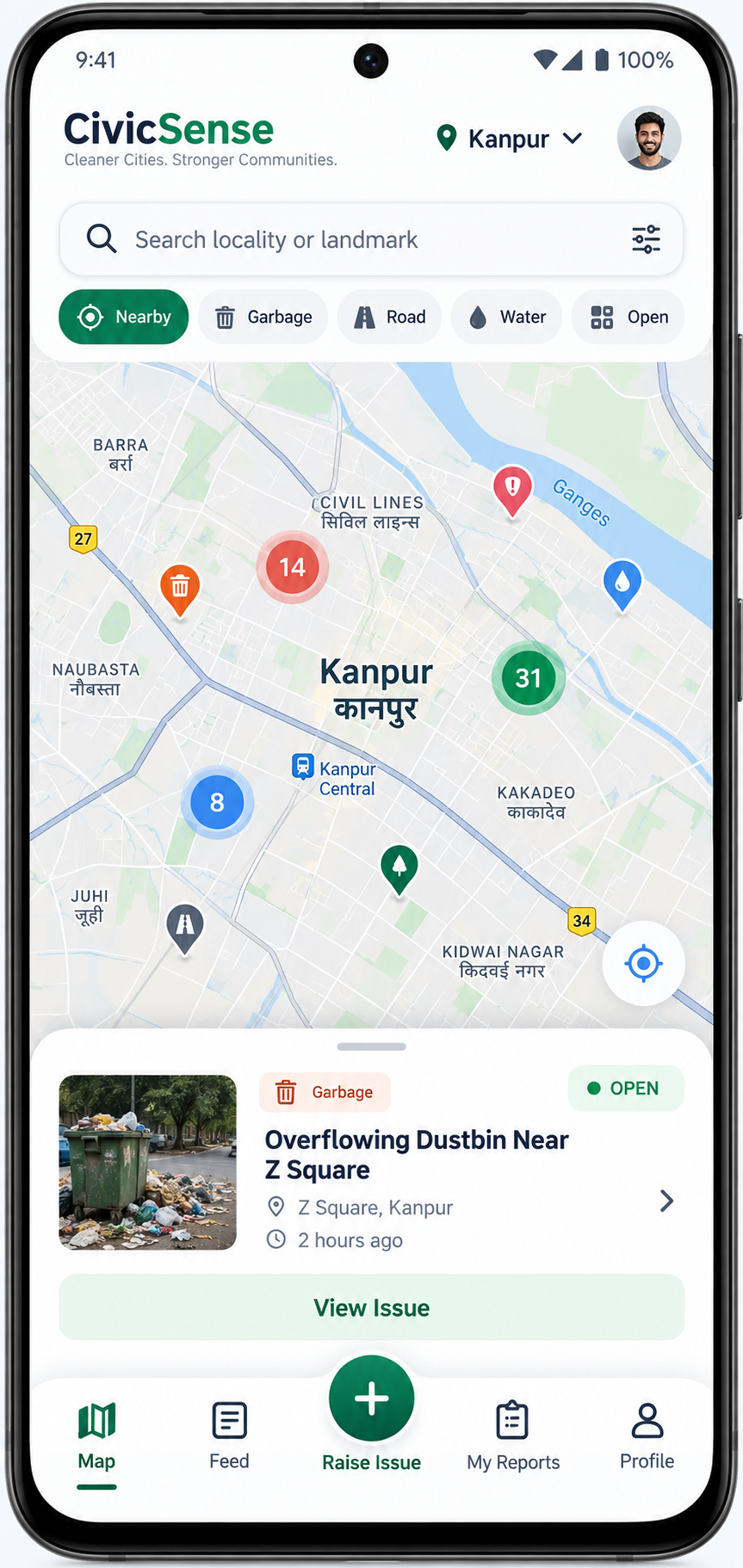
Nearby reportsVisible by locality
Anonymous publiclyPrivate account
Product facts for the Kanpur pilot — live impact metrics will be published after public launch.
HOW IT WORKS
Report in just a few simple steps
From spotting a problem to seeing the resolution — CivicSense keeps the journey visible.
Capture
Take a fresh photo or short video.
Describe
Choose category and add details.
Submit
Location and timestamp are attached.
Track
Follow updates and community confirmations.
See the Change
Before-and-after evidence records resolution.
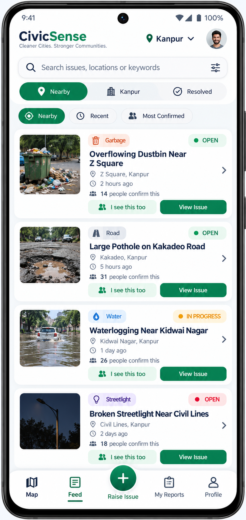
CIVICSENSE APP
Your voice. A cleaner Kanpur.
A simple reporting journey designed around evidence, privacy, and visible follow-through.
- Live map of local civic issues
- AI-assisted issue classification
- Nearby feed and radius filters
- Anonymous public reporting
- Community confirmations
- Resolution timeline
- Before/after evidence
- Android-first, iOS-ready
ISSUE CATEGORIES
Report a wide range of civic issues
Turn a problem you notice into structured, useful civic evidence.
Garbage & Waste
Roads & Potholes
Water & Drainage
Encroachment
Streetlights
Stray Animals
Public Nuisance
Other Civic Issues
Immediate danger is different. For police, fire or medical emergencies, call 112 first.
AI-ASSISTED REPORTING
Less typing. Better civic evidence.
AI helps citizens prepare clearer reports while keeping people in control of what gets submitted.
Category suggestionDescription improvementDuplicate checksImage qualityPrivacy checksHindi / English / Hinglish
AI assists the citizen and moderator. It does not silently make irreversible civic decisions.
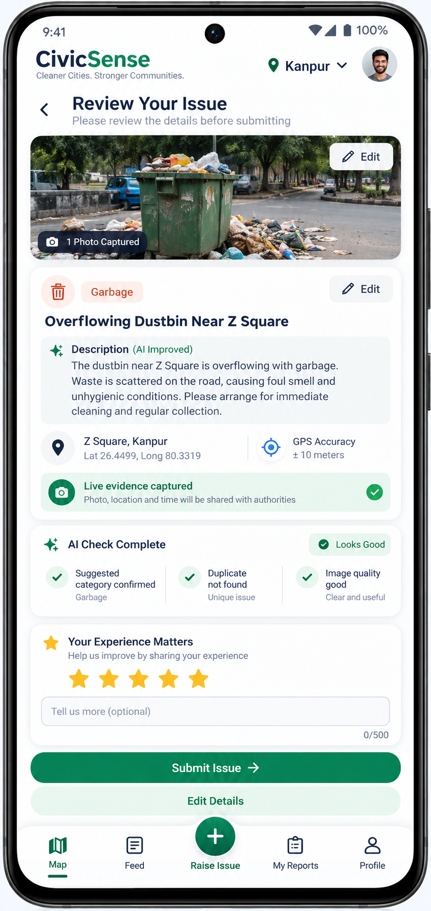
AI check completeYou review before submitting
PUBLIC MAP + FEED
Know what is happening around you.
Discover local issues by place, category, distance and status — then confirm what you can see nearby.
Map clustersNearby radius filtersCategory filtersOpen / In Progress / Resolved“I see this too” confirmationsLocality-level discovery
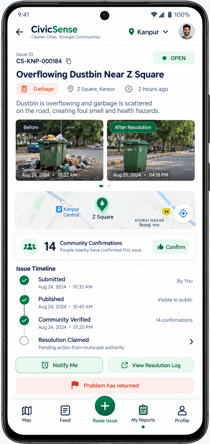
VISIBLE FOLLOW-THROUGH
Reporting is only the beginning.
A public timeline can show what happened, when it changed, and the evidence behind a claimed resolution.
1Submitted
2Published
3Community Verified
4Shared / Routed when available
5In Progress
6Resolution Claimed
7Verified
8Resolved or Reopened
PRIVACY BY DESIGN
Private account. Anonymous public reporting.
Track your own issues without putting your phone number or public profile on the issue feed.
Private with CivicSense
Mobile number
My Reports
Notification settings
Abuse prevention signals
Only civic evidence crosses into public view
Visible publicly
Issue evidence
Category and needed location
Issue timeline
Reported anonymously
INTEGRATION-READY ARCHITECTURE
For Government & Civic Bodies Designed to complement civic systems — not pretend to replace them.
CivicSense can become a citizen evidence and visibility layer, and later connect with authorized systems where permissions and APIs exist.
OUR FIRST CHAPTERKanpur, Uttar Pradesh
Planned pilotKANPUR-FIRST
Starting with Kanpur. Built to scale city by city.
Kanpur is the first city pilot. CivicSense is being designed so geography, categories and routing can later be configured for additional cities without rebuilding the platform.
CityZoneWardLocalityCategoryDepartmentAuthority
COMMON QUESTIONS
Clear answers before you report
Is CivicSense a government app?+
No. CivicSense is an independent civic reporting and accountability platform. Official integrations are shown only when formally available.
Will my name or phone number be public?+
No. Public issues are designed to show the reporter anonymously.
Can I upload an old photo?+
The native reporting flow is designed around fresh camera evidence for stronger trust.
What problems can I report?+
Garbage, roads, drainage, streetlights, encroachment, stray animals, public nuisance and other supported civic issues.
What happens after I report?+
The issue is validated, published when appropriate, mapped, trackable, and can receive community confirmations and resolution evidence.
What should I do in an emergency?+
Call 112 first for immediate police, fire or medical assistance.
KANPUR EARLY ACCESS
Be part of a cleaner, safer Kanpur.
Join the early-access list and help us build CivicSense with citizens, communities and civic stakeholders.